Hello everyone, now that we got the Cayo Perico island released fully by @Hai_tux in the forums (something that you can check here) it was about time to explore it, and I found something a bit “disturbing” for me.
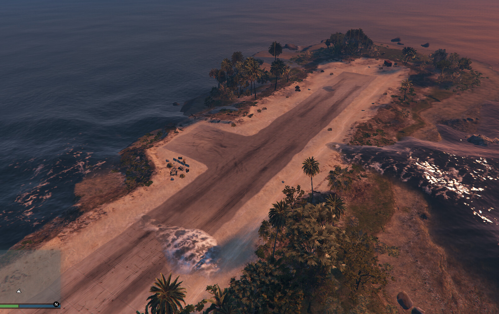
This thing is the water level. I wasn’t expecting that, in this map, the water could rise to a level above the terrain (something that happens in most of addon maps); but well, I found out that happens in certain areas like, for example, in the airport itself:
So, after realising this, I started searching a bit, what could I do to make the water level a bit lower for the whole map. This is what I tried so far without success; first option without any effect, and second with quite an interesting fact that will lead to my main doubt:
1· Following the native examples I found here, I tried to apply ModifyWater and AddCurrentRise calls inside a client loop that executes every frame. Sadly, this didn’t make any difference, so I gave up on trying to modify this via code.
2· Water.xml looked like an attractive way to modify sea level at general, and hell yeah, it does it’s job, but surprisingly, the Cayo Perico Island still presented water level issues, so I tried to, literally, remove all the water around the map, and surprise surprise, this is what I found:

So, for how it looks like, water.xml doesn’t apply after certain coords, even if you specify bigger areas (I did it with areas between -12000.0 & 12000.0 for both x and y). At the last image, the square corner you are seeing is the coord: x: 4500.0, y: -4000.0.
My doubt is if this last fact is true, if water.xml can’t reach further certain limited areas, and if this is the case, is all the water outside this area uneditable?
Thanks for your time and I wish you all a good day ![]()
EDIT: Solution given by d0p3t here
