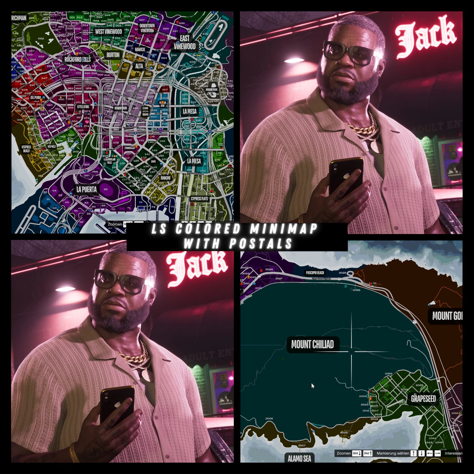
Custom Minimap with Colored Districts and Postal Codes
This high-end custom minimap offers a beautifully detailed, top-down view of the entire map environment, rendered at an exceptional 8192×8192 resolution. Designed for maximum clarity and realism, it delivers pixel-perfect definition from corner to corner — ideal for both immersive gameplay and precise location referencing.
 Colored Districts
The map is divided into clearly defined color-coded districts, with each area uniquely shaded for fast visual identification. The colors are:
- Carefully selected to provide strong contrast between zones
- Visually balanced to avoid oversaturation
- Helpful for orientation, boundaries, and district awareness
This makes neighborhoods or areas instantly recognizable without the need for labels or menus.
 Accurate Postal Codes
Each region features clearly marked postal codes, positioned with accuracy and subtlety. These codes:
- Are placed inside their respective zones with precision
- Are highly legible at full and reduced scales
- Integrate seamlessly into the map’s design without obstructing roads or landmarks
They support quick identification of locations and add a layer of realism to the map layout.
 Visual Quality & Style
- View style: Clean top-down design (non-satellite)
- Detailing: Sharp terrain, road networks, and map outlines
- Color tone: Modern, minimalist, and optimized for long-term viewing
The map’s clean, high-resolution style ensures it scales well for both fullscreen map displays and compact minimap overlays.
Preview (dont got another bc i made it in August 2024):